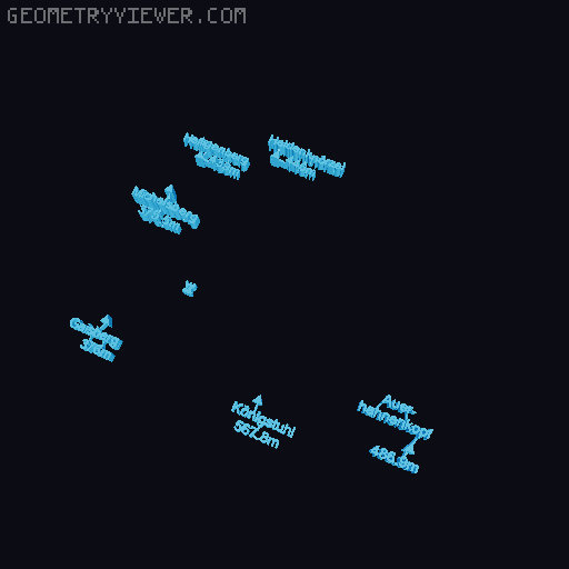
Heidelberg topographical map created with MapLab3D
by AndreasKilthau · via Thingiverse
| Format | STL |
| Category | Art |
| License | CC BY |
| Triangles | 42.5k |
| Uploaded | Mar 15, 2026 |
⬇ 279 downloads
❤ 1 likes
👁 84 views
Description
This model was created using the MapLab3D app. MapLab3D is a tool for creating 3D models of maps in STL format from freely available OpenStreetMap data and elevation data which can be printed on 3D printers without further processing. No other CAD tool is required. This map serves as an example for a detailed tutorial on how to use MapLab3D . By following these instructions, you should be able to create your own maps with your own changes to the standard map layout. Further information about MapLab3D can be found on GitHub and in the MapLab3D Wiki . The instructions based on this map are very detailed, although not all functions of the MapLab3D app are explained. For quick results, take a look at this simple example . This map consists of 2 tiles (T001, T002), 11 different colors (C0xx) and 165 individual pieces. The map size without frame is 250 mm x 130 mm, the wooden back panel (thickness 12 mm) should be slightly smaller so that it fits into the frame. The map size with frame is 290mm x 170 mm. The following colors were used: C001: Tile base: Verbatim Green C002: Legend: Fillamentum PLA Extrafill Traffic White C006: Forests: Fillamentum PLA Extrafill Green Grass C007: Settlement areas: Fillamentum PLA Extrafill Perl Ruby Red C016: Water: Maertz PLA Himmelblau C018: Tertiary and minor highways: Fillamentum PLA Extrafill Light Ivory C019: Secondary highways: Fillamentum PLA Extrafill Traffic Yellow C020: Primary highways: Fillamentum PLA Extrafill Melon Yellow C021: Trunk highways: Fillamentum PLA Extrafill Orange Orange C023, C031: Railways, Texts, Frame: Fillamentum PLA Extrafill Traffic Black C029: Symbols: Fillamentum PLA Extrafill Chocolate Brown
Originally published on Thingiverse